Wednesday, February 29, 2012

There's Hope in Arkansas


February 29, 2012—A place called Hope is about 45 minutes from where we are staying. It is a small town whose main claim to fame is being the boyhood home of President Bill Clinton.

We toured Clinton’s first boyhood home, which was actually his grandparents’ house. It is a modest house across the street from the railroad tracks. His grandparents helped raise him while his mother, who was widowed when she was six months’ pregnant with the future president, went back to school to become a nurse anesthetist. (He grandmother was also a nurse.)
Bill Clinton's first boyhood home in Hope, Ark.

Clinton's second boyhood home in Hope.

The second house he lived in, after his mother remarried, was also modest. It is not open to the public.

Today we spent taking a driving tour of Texarkana, city that spans two states. The state line actually goes down the middle of the post office building. The chamber of commerce provides a CD that describes several highlights in the city. Trust me: It was not difficult to drive and park, to tour the various sites. Texarkana has a total population of about 60,000. The downtown is NOT bustling; it has boarded up storefronts like many other cities its size. So, parking was no problem.
Jim straddles two states--Arkansas and Texas.


Taking the tour was a pleasant diversion. We learned tidbits, such as: Did you know that Ross Perot was from Texarkana? He and his sister provided major funding to refurbish the local theater. We went into the box office and asked if we could see the theater. The lady provided us with a private (free) tour. The ceilings are pieces of artwork. The theater is beautiful.

Another tidbit: Did you know that Scott Joplin was from Texarkana? His compositions did not get much acclaim until the movie The Sting featured his rag music.
Mural of Scott Joplin
Ace of Spades house in Texarkana--an interesting old house 


Later this afternoon, we drove over the dam that forms a huge lake, Milwood Lake, which is adjacent to the RV park where we are staying. The countryside is absolutely beautiful. Trees are in bloom; so are early spring flowers. The countryside changes from flat farmland to rolling hills, all a brilliant green. We saw fields with donkeys, horses, cows, and sheep grazing lazily. Water, in creeks, rivers, and lakes, is abundant. This is not what I envisioned Texarkana to look like. It’s hard to believe that just a couple hundred miles to the west lakes are receding because of draught.

Would I want to live in this area of the country? Probably not. I’m not enamored with Texarkana, and although the countryside is beautiful, it is very rural—too rural for my taste. However, we are going to come back to Arkansas and spend more time in other parts of the state, including the Ozarks. From what we have read, it is a very economical place to retire, with a temperate climate, and it is sort of in the middle of the country, ideal as a central point for travel.

Tomorrow we intend to hunt for diamonds. Oh, yeah…Arkansas has a diamond field open to the public!

Until later,

Your Reluctant RoVer,

Linda

Monday, February 27, 2012

Green, green

February 27, 2012—Spring is springing up all over…in east Texas and Arkansas. The trees are budding; some are flowering. I even saw wild flowers blooming! And the grass is green. It is so refreshing after spending so much time in Arizona and New Mexico where brown is the going color. I missed my green!

I also missed humidity—not that I’m fond of the almost 100% humidity we have at home. But, it is nice not having to rub in medicated lotion after each hand washing. (I never have to use lotion at home.)

For the next five nights, we are staying at an RV resort outside of Texarkana, Arkansas. There are very few people here. And it is very secluded and serene, with woods surrounding it. We haven’t seen the deer that populated our last resort outside of San Antonio (herds of deer, almost tame!), but I’m sure there are critters around.

This resort looks to be pretty nice. We’ll explore more tomorrow, including checking out the onsite golf course. Golf? What’s that? It’s been so long since we’ve had a club in our hands that I think we might have forgotten how to hit the ball. We’ll see.

The resort is also close to Hope, Ark., home of Bill Clinton. We may go there, too.

I think this time will be spent mostly just relaxing—not a bad thing to do, since we’ve been so active the last several weeks.

More to come,

Your Reluctant RoVer,
Linda

Thursday, February 23, 2012

Walking San Antonio

February 23, 2012—My feet hurt! Today we walked—a lot. Fortunately, San Antonio is pretty flat, so we didn’t have to struggle with altitude as we walked its streets to see its history up close.

It is an interesting city. One section, King Williams, was founded by Germans who successfully established and ran commercial businesses in the city in the 19th century. The houses range from mansions to little gingerbread cottages. The architecture is not at all what you would expect in a southwestern state. We decided just to drive around this section of the city instead of hoofing it. We saved that for later.

Our first stop today was the Institute of Texan Cultures, where we had a pleasant surprise. Admission was free today because this afternoon naturalization of about 180 people from 50 different countries was to occur on the site. What a place to become a U.S. citizen! We were invited to stay for the celebration, but it did not fit our schedule. (Too much to see and do!)
Institute of Texan Cultures

The Institute is a museum celebrating the many cultures found in Texas—some of which I had never heard of. (Have you ever heard of the Wends? Me, neither. They were from Lusatia, an area in Germany comprising parts of Saxony and Prussia. They had their own language and fled Germany to Texas because of oppression.)

After touring the museum, we took the tour bus to an area of the city called Market Square, supposedly the oldest and largest market in the country. I doubt it. We were sorely disappointed. Aside from some restaurants, all we found were look-alike shops, most of which sold Mexican imports and Texan memorabilia. The market had two sections—the original and a “new” section built about 20 years ago. The new section was labeled “farmers’ market,” so we assumed we would find greens, fruits, vegetables, and perhaps even meats, in addition to home-baked goods, candies, etc. Nope. None of those things, just more of the same that we found in the “original” market.

We decided not to lunch in the overpriced restaurants that attract the tourists. Instead, we walked the sidewalks toward the downtown area, believing we would eventually come upon a “local” restaurant. We did. It was a small Mexican restaurant, run by Mexican Americans, and whose clientele was Mexican Americans. I ordered the cheese enchilada special—two cheese enchiladas, Mexican rice, refried beans, a bit of salad with guacamole, and iced tea. All of this for $4.75. It also came with homemade corn tortillas. I don’t think I’ve ever tasted a tortilla that good! Our advice: Always look for hole-in-the-wall local restaurants. We’ve rarely been disappointed in the fare.

After lunch, we walked (and walked and walked) to another old section of the city called La Villita (little village). When the Alamo was under attack, Santa Ana was headquartered here. Today the buildings house artisan shops.

Finally we reached Hemisfair Park, the park site of the 1968 Hemisfair (world’s fair). A few buildings remain; none are open. As we walked through the park on the way to the Tower of the Americas (like the Seattle Space Needle), we spied a bicycle rack—not just an ordinary rack, though. In San Antonio it is possible to rent a bicycle for $10 for 24 hours. Using a credit card, you “purchase” your rental, ride to your destination, and park the bike in these special racks. When you are ready to go to your next destination, you merely take an available bike and keep doing this until your 24 hours are up (or you finally get to your destination). Interesting concept.


Our final destination of the day was to ride up to the observation deck of the Tower of the Americas. It is 750 feet high—as high as we went deep when we were at Carlsbad Caverns. The views were excellent.
It was a busy day. I like San Antonio; it reminds me, in a way, of modern-day Indianapolis, which has done similar things to its downtown area and its canals. San Antonio is the second-biggest city in Texas—much larger than I would prefer living in, but it is a nice, clean city that knows how to attract tourists and keep people in its downtown area. Jacksonville could learn from it.


Tomorrow, weather permitting, we are going to the Johnson Ranch in the Hill Country.

Until later,

Your Reluctant RoVer,

Linda

Davey, Davey Crockett...

February 22, 2012—When I was about 10 or 11 years old, Davey Crockett (King of the Wild Frontier) was one of the top children’s TV programs. My brother John and I watched it religiously, and afterwards, in our play, we re-enacted the episodes. Yes, I admit, I was a tomboy, and as such, I had to have a coonskin cap. Johnny and I would put on those caps, take out of toy rifles, and set out to hunt Indians and trap bear. What fun! (Do kids do those things today? If they don’t they don’t know what they are missing.)

Today, we visited the Alamo, where Davey Crockett, Jim Bowie and 146 (or so) others sacrificed their lives in a battle in February 1836 against the Mexican leader Santa Ana. In their quest for independence, Texas volunteers captured the Alamo, one of five mission/forts in San Antonio area, from the Mexicans. Santa Ana was determined to recapture it and teach the Texans a lesson. He succeeded. No one survived the 13-day siege.
The Alamo

Although I lived in Texas for two years, I had never traveled the 90 miles or so from my house to San Antonio to see the Alamo. It had always been on my “to do” list. My friends told me, “The Alamo is nothing, but you’ll love the River Walk.” They were right.

What a disappointment the Alamo was! The section of the mission that survived the siege has been partially restored. Visitors can take photos of the outside of the building, but they are forbidden from taking any pictures inside the building! Another thing: Men are required to remove their hats. This is a big deal: Texans don’t remove their hats—ever! Not even in classrooms nor in restaurants. Jim forgot and was irked when an attendant reminded him.

The River Walk, the first in the nation to be created, was another story. My Texan friends were right: It was very nice. Lined with shops and overpriced restaurants the river winds throughout the city for a couple of miles. (The city is extending the walking trail.) As part of a tour package we purchased, we took a 30-minute narrated boat ride along the River Walk and learned the history of the various buildings and of the River Walk itself.


The tour package also included an IMAX movie on the fight for the Alamo, and a hop-on/hop off two-day tour of the city. We took the 60 minute narrated bus tour; tomorrow we are going back to visit some of the places on the tour, such as two of the remaining missions and a section of the city founded by Germans.
Speaking of Germans…over the years, a large number of Germans immigrated to Texas. The names of several towns bear witness to this—for example, Boerne and Fredericksburg. We passed through Boerne to reach our RV campsite, and yesterday we visited Fredericksburg.

We both loved Fredericksburg. It is a town of about 25,000 that has learned how to survive the influx of big box stores by capitalizing on its heritage. The downtown was filled with tourists who shopped in German-themed stores and ate in German-themed restaurants. This town was friendly, clean, and vibrant. It is located in the middle of the Texas Hill Country (absolutely gorgeous scenery). I could easily live there.

Fredericksburg is also home to the National Museum of the Pacific War, which we visited. It is a memorial to those who fought in the South Pacific, where my father fought. The museum comprises three locations: The first is in the Admiral Nimitz Museum, located in the hotel the Nimitz family owned and describes Admiral Nimitz’ life. (He was in charge of the Pacific naval theater.) The second location is in the Museum of the Pacific War. It is a typical museum, with interactive exhibits describing all facets of the Pacific war.

The third location lies a couple of blocks away from the other two. At this site, part of the Museum of the Pacific War, a guide takes visitors through a building that houses artifacts, including a real PT boat (the kind that John Kennedy commanded).
PT boat

As a Navy veteran, Jim really enjoyed the Nimitz museums.

Me? I’m not “into” war museums very much. I enjoy natural things, such as the Sonora Caverns, which we visited the day before. We had time, so when we saw the signs for Sonora Caverns we decided to stop. These caves, privately owned and operated, are living caves, as opposed to Carlsbad Caverns, which are “dead.” The formations were much more beautiful and reminded me of the Squire Boone Caverns in southern Indiana.


We’ve been busy! And we’re having a great time—so much that we decided to stay here a couple extra days. This RV park, part of our Thousand Trails membership, is on a lake (which, unfortunately has suffered from the prolonged Texas drought) and in a woods. Although we are disappointed in the lack of amenities (no cable, WIFI only in the club house, pool table and mini-golf course in less-than-pristine shape), it is located in the heart of the Hill Country, and that makes up for a lot.

Until next time,

Your Reluctant RoVer,

Linda

Sunday, February 19, 2012

A really BIG hole in the ground

February 19, 2012—If you want to see a really, really big hole in the ground—750 feet beneath the surface—visit Carlsbad Caverns in New Mexico.

We were among the first visitors to the caves this morning. To get there, you have to traverse a mountain; the caves are at an altitude of about 4,400 fit—not as high as we have been in the last couple of days, but high enough. (I don’t like driving on mountain roads.)

Once at the caves you have two choices: to enter through the natural entrance, which requires a downhill walk of about a mile or more, or the elevator, which takes you down 754 feet in a matter of about one minute. We opted for the elevator.


A number of tours are available. Most people (we included) opt for the self-guided tour of the big room. It takes about one and one-half hours to go about the mile and a half circle. The path is easy to walk and is even wheel-chair accessible in most areas. There are some areas, however, that require climbing an incline. Fortunately, occasional benches are provided for resting.


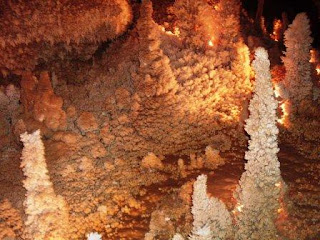
For size, the caverns cannot be matched. For formations, I rate Mammoth Cave in Kentucky and Squire Boone Caves in southern Indiana much higher. The difference, I believe, is caused by how they were formed, with the caves in Kentucky and Indiana basically being formed by water seeping through the soil, just as sink holes are formed. (Sink holes are essentially caves without a roof.)


Although the formations were not as glorious as in other caves, it was well worth the time to take the tour.
I’ve included a number of pictures that do not do the caves justice. It is very difficult to take good photos in a dark environment.


Until next time,

Your Reluctant RoVer,

Linda

Saturday, February 18, 2012

The aliens have landed!

February 18, 2012—Roswell, N.M., has a certain mystique. In 1947 reportedly an alien space craft crashed outside of the city. T

Jim tends to believe in life outside of Earth. Me? Not so much…but maybe. It doesn’t matter. We are in New Mexico, and we wanted to visit Roswell, the birthplace of ET belief.

Roswell is only 75 miles from Ruidoso, but what a difference! Ruidoso is in the mountains and receives considerable precipitation. When we got to the east side of the mountain, the vegetation abruptly changed to the kind that lives in semi-arid (then arid) conditions.

We were surprised by Roswell. We thought we would find a tired, dusty crossroads of a town. Instead, we discovered a pretty vibrant mid-sized city that is home of two colleges and a lot of different industry.

The two primary alien attractions are in the old downtown area. We first went to the International UFO Museum and Research Center, which is housed in an old movie theater. The people who run this nonprofit organization take themselves seriously. They want to prove that the Roswell crash did occur, and that aliens do exist.


Admission for us old-farts was only $3 each. You could spend an entire day in the museum, if you wanted to read every piece of “proof” the researchers have posted, because most of the exhibits consist of old photos and newspaper articles.

Our Internet research told us that there was a “kinky” place called Alien Zone. At first we didn’t see it, and we started to leave town without visiting it. But, as we were driving away, I saw the “museum,” and we stopped.

We were glad we did.

Yes, it was as corny as a bowl of corn flakes, but it was fun! No “research”…this place just had “aliens” posed in various scenarios. For the price of admission (again $3 each), we could sit and “chat” with all the aliens and take all the pictures we wanted. When we left, we each bought a tee short for the reasonable cost of $7 each.

If you ever go to Roswell, be sure to go to the Alien Zone. You can skip the International UFO Museum, unless you want to learn all about the supposed 1947 crash. But be sure to take your picture with ET.

Until next time,

Your Reluctant RoVer,

Linda  

An inexpensive repair, a late start, and a cold and snowy trip

February 17, 2012—In my last blog post, I reported that we were waiting for a mechanic to fix our compressed-air problem. I’m happy to report that he finally got to the park and found the cause of the problem: The governor on the compressor malfunctioned. He replaced the governor, and we were back in business. I’m glad we had purchased the Good Sam Emergency Road Service, which pays for the first hour of help. The cost to us? $50, and that included the cost of the new governor! That was a pleasant surprise.

Since we got off to a late start (2:30 p.m.), we drove until it got dark and dry-camped at Walmart in Alamogordo, home to White Sands Testing. The sands really are white! It was too late to go to the White Sands National Monument, so I only managed to take pictures of the sands from our moving motorhome. (After our experience at Imperial Dunes, I wasn’t too crazy about venturing into any more dune areas, regardless of their color!)


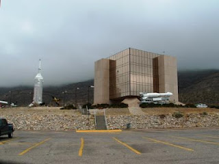
Alamogordo is home to an air force base, testing grounds, and the New Mexico Space Museum, which we visited this morning. The museum had all types of memorabilia, including the speed sleds used to test G-forces on the human anatomy. As a side note: HAM, the first chimp in space, is buried onsite.


Our plan for today was not only to visit the Space Museum, but to travel a bit farther north and see one of the largest areas of petroglyphs in the United States, then to visit the Valley of Fire in an area known as Malpaís (translation: bad country). From there we would spend the night in an RV park in Ruidoso, which, we learned, is in ski country. The problem with our plan was that last night’s weather forecast predicted several inches of snow where we wanted to go.


We are not prepared to drive in snow. We decided to watch the weather and proceed with caution. And that we did—watching the temperature drop and seeing snow in the distant mountains.

The Three Rivers Petroglyphs boasts more than 21,000 petroglyphs, created by a group of prehistoric Native Americans called the Jornada Mogollon. The pictures were made with stone tools by artists who removed the dark patina on the exterior of the rocks.

The literature provided by the Bureau of Land Management (BLM) said it is not known why there were so many petroglyphs created in this area, or what they actually meant. Jim and I decided to make up our own history: We believe that the drawings were made by students, who, having demonstrated some artistic ability using charcoal, were sent to the rocks to practice their etchings before doing them on the walls of caves. 

That’s our story and we’re sticking to it! Whatever their reason for being, the petroglyphs really are amazing. They show animals, people, snakes, birds, and other objects. Going to this site was worth the drive.
The temperature continued to drop, little by little, and the skies looked cloudy, but we decided to press on. 

Our next stop was an area called Malpaís, literally meaning “bad country.” This 125 square mile area is a lava flow that goes down 160 feet at the center. The black rock formed by the lava looks like burnt rock—hence the name, Valley of Fires. It is an extremely forbidding place. Information on the area says that a few prospectors and ranchers have attempted and failed to make a living in this area. It is easy to see why. It really does look like a burnt-out forest.


After a good lunch of cocina saborosa Mexicana (delicious Mexican food, as the restaurant boasted—and it was), we called the RV park in Ruidoso to find out if the roads were clear. We were assured the snow had stopped several hours earlier; the roads were clear.

Ruidoso, according to the BLM ranger at the petroglyph site, lies at a higher elevation. As the crow flies, it was only about five miles from the petroglyphs. We could not fly, however. We had to transverse a very windy highway around and up a mountain.

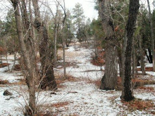
The countryside changed. Instead of arid desert, we found ourselves in snow-covered forested countryside. It is very beautiful. The RV park abuts a “river” (actually a small creek). Over the last couple of days, I’ve spoken with the owners several times. They told us they just moved here from Texas and took possession of the park two days ago. Nice people. I think there are only two or three people staying here right now.


There is snow on the ground, and it is cold. It may also snow again tonight, so we may or may not be traveling down to Carlsbad Caverns tomorrow. Who cares? It is pretty here; we are warm; and we have plenty of food in the ‘frig.

The only thing we don’t have is cell-phone service or Internet access. Oh, well. We’ll live without those amenities for a day or two, and I’ll post this when we get back to “civilization.”

Until next time,

Your Reluctant RoVer,

Linda


Back home again...

Rob and I hit the road about 1:30 p.m. on Thursday, June 15. The movers were incredible: They had everything loaded into the huge moving tru...